|
|
|
Advertisements:
GeographyLocation
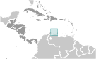
Caribbean, island in the Caribbean Sea, north of Venezuela Geographic coordinates
12 30 N, 69 58 W
Map references
Central America and the Caribbean
Area World Ranking: 217
Total 180 sq km
Land 180 sq km Water 0 sq km Area - comparative
Slightly larger than Washington, DC Land boundaries
0 km
Coastline
68.5 km
Maritime claims
Territorial sea 12 nm
Climate
Tropical marine; little seasonal temperature variation Terrain
Flat with a few hills; scant vegetation Elevation extremes
Lowest point Caribbean Sea 0 m
Highest point Ceru Jamanota 188 m Natural resources
NEGL; white sandy beaches
Land use
Arable land 10.53%
Permanent crops 0% Other 89.47% (2005) Irrigated land
NA (1998 est.)
Natural hazards
Hurricanes; lies outside the Caribbean hurricane belt and is rarely threatened Environment - current issues
NA
Geography - note
A flat, riverless island renowned for its white sand beaches; its tropical climate is moderated by constant trade winds from the Atlantic Ocean; the temperature is almost constant at about 27 degrees Celsius (81 degrees Fahrenheit)
Comments
Add a new comment: |
Advertisement
Members area
Aruba [ Netherlands ] (Kingdom Of The Netherlands):
 
GPS points from Aruba [ Netherlands ] (Kingdom Of The Netherlands)
|
||||||||

 Discovered and claimed for Spain in 1499, Aruba was acquired by the Dutch in 1636. The island's economy has been dominated by three main industries. A 19th century gold rush was followed by prosperity brought on by the opening in 1924 of an oil refinery. The last decades of the 20th century saw a boom in the tourism industry. Aruba seceded from the Netherlands Antilles in 1986 and became a separate, autonomous member of the Kingdom of the Netherlands. Movement toward full independence was halted at Aruba's request in 1990.